Start: Miami, FL
Your journey begins in Miami, a bustling city with vibrant culture and nightlife. Before hitting the road, make sure to stock up on fishing gear, bait, and snacks for the trip. Now, let’s head south to the Florida Keys!
Biscayne National Park (Homestead)
- Address: 9700 SW 328th St, Homestead, FL 33033
- Distance from Miami: ~40 miles
- Fishing Spot Coordinates: 25.4824° N, 80.2104° W
Located near Homestead, Biscayne National Park offers shore fishing opportunities in a pristine environment. Cast your line near Convoy Point or explore the mangroves for snapper, tarpon, and snook. The park’s crystal-clear waters and lush surroundings are a perfect start to your fishing adventure.
Key Largo – John Pennekamp Coral Reef State Park
- Address: 102601 Overseas Hwy, Key Largo, FL 33037
- Distance from Biscayne National Park: ~30 miles
- Fishing Spot Coordinates: 25.1232° N, 80.4064° W
This state park is famous for its underwater coral reefs, but it also offers excellent shore fishing along its designated areas. Look for snapper, grouper, and barracuda near the mangroves or from the park’s marina area.
Islamorada – Long Key Bridge
- Address: Mile Marker 63, Overseas Hwy, Long Key, FL 33001
- Distance from Key Largo: ~40 miles
- Fishing Spot Coordinates: 24.7983° N, 80.8363° W
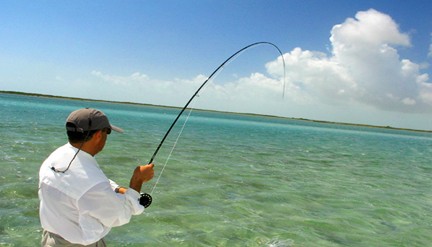
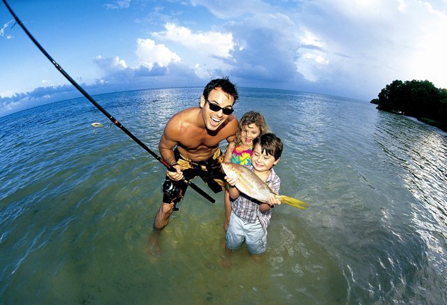
Known as the “Sportfishing Capital of the World,” Islamorada is a must-visit for anglers. Long Key Bridge, one of the longest bridges on the Overseas Highway, is a hotspot for shore fishing. Set up near the bridge’s base and cast for tarpon, snook, and mangrove snapper. This is my favorite place on earth, and my favorite place to stay is Cheeca Lodge.
Marathon – Seven Mile Bridge (Old Bridge Access)
- Address: 33050 Overseas Hwy, Marathon, FL 33050
- Distance from Islamorada: ~30 miles
- Fishing Spot Coordinates: 24.7056° N, 81.1563° W
The Seven Mile Bridge is one of the most iconic landmarks on the drive to Key West. While fishing from the modern bridge is not permitted, the old bridge offers shore fishing access. This area is teeming with tarpon, grouper, and jack crevalle, especially during dawn and dusk. If you’re arriving by private plane, Marathon also has a private airport, making it a convenient spot for travelers looking to fish and explore the area.
Bahia Honda State Park
- Address: 36850 Overseas Hwy, Big Pine Key, FL 33043
- Distance from Marathon: ~12 miles
- Fishing Spot Coordinates: 24.6602° N, 81.2765° W
With its sandy beaches and crystal-clear waters, Bahia Honda State Park is a paradise for anglers. The old Bahia Honda Bridge provides access to deeper waters where you can catch snapper, barracuda, and tarpon. Don’t forget to enjoy the stunning views of the Atlantic Ocean and the Gulf of Mexico.
Lower Keys – Sugarloaf Key (Sugarloaf Channel)
- Address: Sugarloaf Blvd, Sugarloaf Key, FL 33042
- Distance from Bahia Honda: ~20 miles
- Fishing Spot Coordinates: 24.6473° N, 81.5416° W
Sugarloaf Key’s quiet and serene atmosphere makes it a great spot for shore fishing. The Sugarloaf Channel is a popular area to target tarpon, bonefish, and permit. Bring along some live bait for the best results.
Destination: Key West, FL
- Distance from Sugarloaf Key: ~20 miles
You’ve made it to Key West, the southernmost point in the continental United States! After a long drive, enjoy the vibrant nightlife, historic landmarks, and stunning sunsets. For anglers, head to Mallory Square or Fort Zachary Taylor Historic State Park to cap off your fishing adventure with some shore fishing in Key West’s rich waters.
Tips for Fishing Along the Overseas Highway
- Fishing License: Make sure to obtain a Florida saltwater fishing license, which can be purchased online or at local bait shops.
- Gear: Bring medium to heavy rods, a variety of hooks, and live or artificial bait depending on the species you’re targeting.
- Timing: Early mornings and late afternoons are the best times for fishing, especially during tide changes.
- Safety: Be mindful of traffic when parking near bridges and always wear sunscreen.
The drive from Miami to Key West is not just a journey; it’s an adventure filled with natural beauty and unforgettable fishing opportunities. Tootle will be adding all these special fishing spots in the near future, but until then, here’s how you can enter the coordinates on Google Maps:
- Open Google Maps on your device or browser.
- Type or paste the coordinates into the search bar. For example: “24.7056, -81.1563”.
- Press ‘Enter’ or tap the search icon.
- Google Maps will drop a pin at the location, providing directions and additional information.
With this guide, you’re set to experience the best shore fishing spots along the Overseas Highway. Happy fishing!